VLINDER for researchers
VLINDER data are in realtime online available and interested researchers can use them. But there is more...
Meteorological data in very diverse landscapes have a large value and will be used during the next years to evaluate high-resolution weater forecasts and to gain insight into the urban heat island phenomenon in Flanders and Brussels. Results will be published in international research journals.
But the potential of this network is not limited to meteorological research. As an example, the data of the MOCCA netwerk, an urban climate monitoring network in Gent, are used by architects, engineers, geologists,... The VLINDER project results in an even more extensive database and all measurements are immediately online. Researchers interested in working with the data, can contact the VLINDER team for more information (e.g. metadata,...).
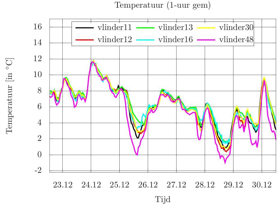 Temperature measurements (1 hour averages) for the VLINDER stations in the Antwerp region. Remark the urban heat island (4°C temperature difference
 between rural Vlinder 48 Sint-Gillis-Waas and Vlinder 13 Antwerpen in city center of Antwerp) during the Christmas night.
VLINDER as a modular network
The availability of 59 identical, highly-accurate weather stations in very diverse landscapes makes the VLINDER network unique and attractive for other applications. There are indeed many other parameters (e.g. air pollution, noise,...) that are significantly influenced by the local environment. The energy and communication infrastructure is developed such that extra sensors can be easily connected to the VINDER stations. In this way the VLINDER meteorological network can be easily extended towards e.g. a Flemish air pollution network. Today tests with experts from other domains are already undertaken to prepare such extensions.
Researchers interested in more measurements (e.g. via extra sensors), can contact us.