The VLINDER project
Weather and climate are of large importance in today's society. Increasing computer power enables to run weather models at ever higher resolutions, but this creates a need for more local weather data. This unique citizen science project gathers researchers, high schools and local partners to initiate a Flemish network of weather stations to collect meteorological data in landscapes where we do not have information today.
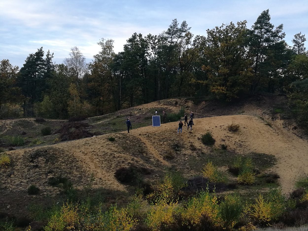 Students of the Sint-Augustinusinstituut (Bree) just finished the installation of VLINDER weather station 17
on top of the highest land dune of Flanders.
Students of the Sint-Augustinusinstituut (Bree) just finished the installation of VLINDER weather station 17
on top of the highest land dune of Flanders.Land use (e.g. buildings, forests,...) has a significant impact on the atmosphere. Given the increasing spatial resolution of atmospheric models, understanding the land-atmosphere interaction gains importance. But reliable weather observations are mostly limited to rural and open landscapes.The VLINDER project, operational since December 2019, aims at filling this gap by building a regionwide climate monitoring network measuring in all landscapes present (rural, urban, industrial, forests, lakes,...). As a research group it is nearly impossible to initiate a network on such a scale. But by following a citizen science approach the story changes... In this project high schools are involved during the complete duration: they search for scientifically valuable measurement locations, they build and maintain the weather stations and they analyse the collected data.
The VLINDER project is supported by the EWI Department in the context of their citizen science program. To maximize both the citizen and science impact of the project, it is built upon a large consortium consisting of partners with very different scientific, technological and outreach expertise.
The VLINDER network
Today the VLINDER network consists of 59 weather stations located in very diverse landscapes. The locations are selected such that all landscapes of Flanders and Brussels are represented in the network. Some VLINDER stations are located in highly urbanized landscapes and industrial environments. But others can be found in natural landscapes like forests, dunes or lakes. Many locations have been proposed by collaborations including schools, local communities and companies.
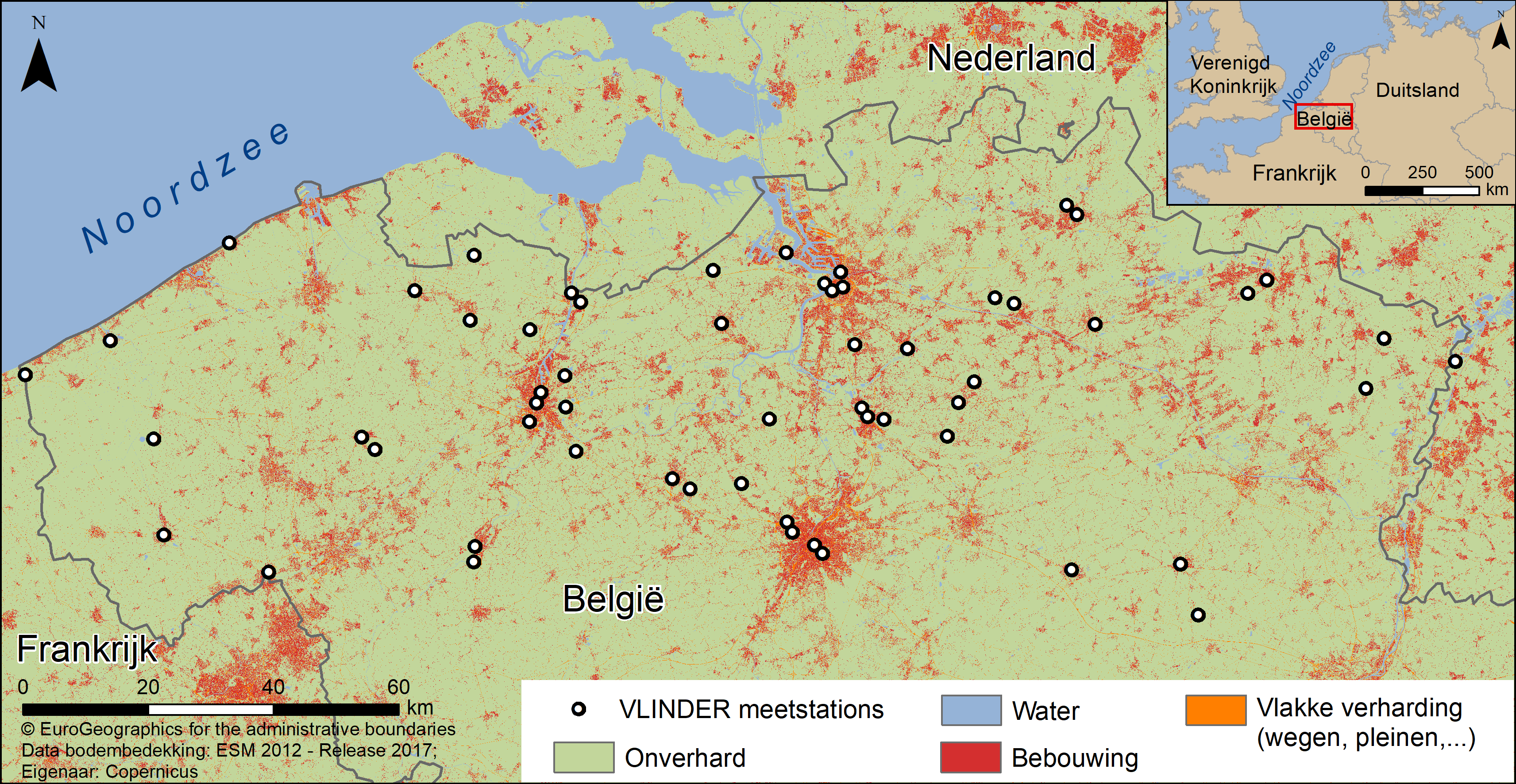 Overview map of the 59 VLINDER locations in Flanders and Brussels.
The VLINDER weather station
For the measurements an accurate weather station, easy to build for students, has been developed by Ghent University. The meteorological sensors (Davis Vantage Pro 2) are accurately measuring temperature, relative humidity, wind and precipitation. The data communication is based on state-of-the-art Internet-of-Things (IoT) technology. A solar panel combined with a battery is used to power the weather station. The battery has a capacity sufficient to survive 1 month without incoming solar light. An Arduino based microcontroller is used to manage the sensors and data communication. The weather station has been developed in such a way that students can easily and safely build and install it.
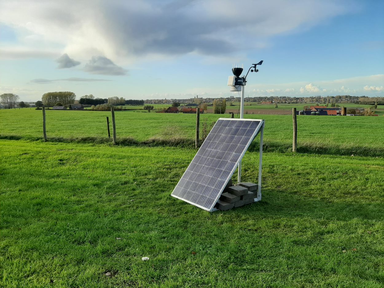 VLINDER station 53 at Poelberg (Tielt) installed and maintained by VTI Tielt.
Curious to see the measurements for your region? Have a look at the realtime VLINDER dashboard.